
|
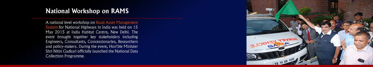
Launching of National Data Collection Program |
|
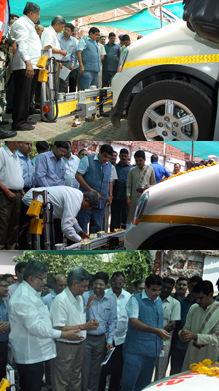
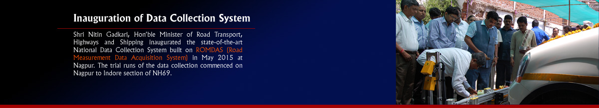
Shri. Nitin Gadkari, Minster of Road Transport, Highways and Shipping
launched the state of the art integrated data collection system for all National
Highways in India on 15 May 2015. This is in line with the Ministry's vision of
using Information Technology as a decision support system in strengthening, maintaining
and upgrading National Highways.
The collection of requisite data in over 3,000 km of the pilot road network is underway as part of the Prime Minister's Digital India initiative. The data collection started from Nagpur on trial basis in May 2015 and it is expected that 150 km will be covered in one direction per day. Complete baseline data for 3,000 km will be available by September 2015. Two years of time series data will be collected for 3,000 km in 2016 and 2017 as part of the program. The survey vehicle currently used for Data Collection is equipped with three cameras including pavement view, 15 advanced Lasers and GPS connected to Gagan satellite. The National Data Collection Program will act as a stepping-stone and will be of immense value in preparing Detail Project Reports (DPRs), as they will have all the requisite data such as soil condition, road condition, curves etc. The Government plans to come out with DPRs on 50,000 km of highway projects, which also includes Northeastern and hilly states. The outcome of integrated data collection system will assist in developing an accurate and scientific maintenance planning mechanism, finalizing road safety measures and development of the National Highways network in India. The data collected will be stored and managed through a web-based application, which will be hosted in the public domain. The application, when fully developed, can also be accessed by smart phones. The software will be equipped to interface with the indigenous Bhuvan satellite images. Information collected for this program will be useful for Transport Ministry, Finance Ministry, NHAI, State PWDs, Police Departments, funding agencies, developers and citizens. |